How stream networks pulse with rainfall
Stream networks are often mapped as fixed features, but they actually extend and retract as the landscape wets up and dries out. Researchers from University of California (UC) and ETH Zurich have been tracking how much stream networks stretch and shrink in response to rainfall and drought. Their study is the first attempt to estimate this dynamic behaviour at a large scale across the continental United States.
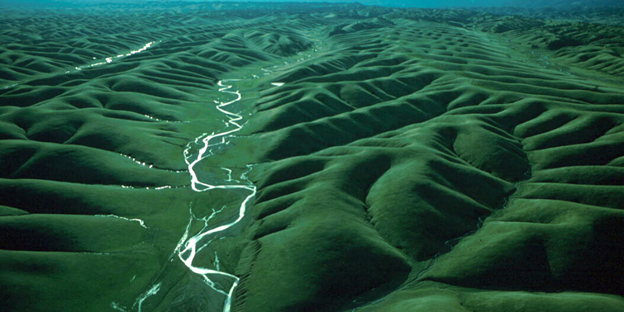
Jeff P. Prancevic and colleagues estimate that the total length of a typical US stream network is roughly five times greater in wet conditions than in dry conditions. This implies that roughly 80% of the total stream length in the US, mostly in headwater channels, runs dry for at least a few days per year. There are big differences in the variability of stream-network length across the country. Places with more variable precipitation have more variable stream networks, but topography is just as important, or more so, in controlling how much stream networks extend and retract.
A moving target
The implications are far-reaching. Other researchers have recently been chasing a cumulative measure of stream length and now Prancevic and colleagues show that they’re chasing a moving target. Understanding how stream network length varies with landscape wetness will improve estimates of greenhouse gas release from headwater channels, habitat availability, and the transport of nutrients, sediment, and contaminants. This is particularly important for predicting how streams will respond to a changing climate. And it gives us new insight into how river networks pulse when it rains.
Reference
Prancevic JP, Seybold H, Kirchner JW. Variability of flowing stream network length across the US. Science 387, 782-786 (2025). DOI: external page 10.1126/science.ado2860